 sun .5deg.com
Bayt Līd, Palestinian Territory (West Bank, Tulkarm) Sunrise, Sunset, Sun position (Altitude, Azimuth), Twilight and Daylight For day: 2026-11-20.
All times are shown in Bayt Līd local time (GMT+02:00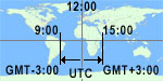 ).
Night, Twilight, and Daylight Times in Bayt Līd for this day: 2026-11-20
 |
Zone Type | Start | End | Length |
| Night | 00:00:00 | 04:47:48 | 4h 47m 48s | |
| Astronomical Twilight | 04:47:48 | 05:17:04 | 29m 16s | |
| Nautical Twilight | 05:17:04 | 05:46:52 | 29m 48s | |
| Civil Twilight | 05:46:52 | 06:13:00 | 26m 8s | |
| Daylight | 06:13:00 | 16:37:07 | 10h 24m 7s | |
| Civil Twilight | 16:37:07 | 17:03:14 | 26m 7s | |
| Nautical Twilight | 17:03:14 | 17:33:02 | 29m 48s | |
| Astronomical Twilight | 17:33:02 | 18:02:19 | 29m 17s | |
| Night | 18:02:19 | 23:59:59 | 5h 57m 40s |
Sunrise, Sunset and Solar noon here: Bayt Līd, PS, for day: 2026-11-20.
| Sunrise | Solar noon | Sunset | |
| Time | 06:13:00 | 11:25:03 | 16:37:07 |
| Azimuth | 112.8° | 180° | 247.1° |
| Day Length |  |
10h 24m 7s |  |
Distance Earth-Sun (Center-to-center
 12:00):
147 803 408 km91 840 780 mi
0°= North, 180°=South

 Solar noon


Table view of above data:
(Azimuth: 0°=North, 90°=West, 180°=South, 270°=East)
| Time | Altitude | Azimuth |
| 000 | -75.1° | 33.6° |
| 100 | -65.3° | 64.8° |
| 200 | -53.2° | 79.4° |
| 300 | -40.6° | 88.9° |
| 400 | -27.9° | 96.5° |
| 500 | -15.4° | 103.7° |
| 600 | -3.4° | 111.1° |
| 700 | 8.1° | 119.4° |
| 800 | 18.6° | 129.1° |
| 900 | 27.6° | 141° |
| 1000 | 34.3° | 155.5° |
| 1100 | 37.8° | 172.5° |
| 1200 | 37.4° | 190.3° |
| 1300 | 33.4° | 206.9° |
| 1400 | 26.3° | 221° |
| 1500 | 17° | 232.5° |
| 1600 | 6.3° | 241.9° |
| 1700 | -5.3° | 250° |
| 1800 | -17.4° | 257.3° |
| 1900 | -30° | 264.5° |
| 2000 | -42.6° | 272.2° |
| 2100 | -55.2° | 282.1° |
| 2200 | -67.2° | 298° |
| 2300 | -76.2° | 334° |
| 2400 | -75.3° | 33.8° |