 sun .5deg.com
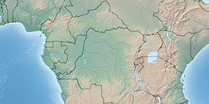
Sunrise, Sunset and Sun position here: Ibanda, Uganda (Western Region, Ibanda District).
Current time: Friday, 2026-07-31, 18:58 (GMT+03:00) Africa/Kampala
.
All times are shown in Ibanda local time.
Solar noon Today was at: 13:04 (elapsed time: -5h 55m),
Maximal altitude of Sun: 71.5°.
Day Length: 12h 6m 46s (time between sunrise and sunset).
Today was at: 13:04 (elapsed time: -5h 55m),
Maximal altitude of Sun: 71.5°.
Day Length: 12h 6m 46s (time between sunrise and sunset).
| Sunrise | Solar noon | Sunset | |
| Time | 07:01:03 | 13:04:26 | 19:07:49 |
| Azimuth | 71.6° | 0° | 288.3° |
| Day Length |  |
12h 6m 46s |  |
Current distance Earth ↔ Sun:
Center-to-center: 151 845 396 km
94 352 355 mi
Ibanda ↔ Sun, nearest point: 151 149 548 km
93 919 975 mi

| Local timezone: | GMT+03:00 |
| Latitude: | -0.13398° |
| Longitude: | 30.49616° |
| Country: | Uganda Western Region |
| Population: | 31 000 |
| Zone Type | Start | End | Length | |
| Night | 00:00:00 | 05:48:41 | 5h 48m 41s | |
| Astronomical Twilight | 05:48:41 | 06:14:03 | 25m 22s | |
| Nautical Twilight | 06:14:03 | 06:39:20 | 25m 17s | |
| Civil Twilight | 06:39:20 | 07:01:03 | 21m 43s | |
| Daylight | 07:01:03 | 19:07:49 | 12h 6m 46s | |
| Civil Twilight | 19:07:49 | 19:29:32 | 21m 43s | |
| Nautical Twilight | 19:29:32 | 19:54:49 | 25m 17s | |
| Astronomical Twilight | 19:54:49 | 20:20:11 | 25m 22s | |
| Night | 20:20:11 | 23:59:59 | 3h 39m 48s |
Altitude 0-24, Current: 1.3° (
 18:58)
Azimuth 0-24, Current: 288.3° ( 18:58)

 Solar noon


| Yesterday | Today | Tomorrow | |||
| date: | 2026-07-29 | 2026-07-30 | 2026-07-31 | 2026-08-01 | 2026-08-02 |
| Day: | Wednesday | Thursday | Friday | Saturday | Sunday |
| Sunrise: | 07:01:08 | 07:01:06 | 07:01:03 | 07:01:00 | 07:00:56 |
| Solar noon: | 13:04:31 | 13:04:29 | 13:04:26 | 13:04:23 | 13:04:18 |
| Sunset: | 19:07:55 | 19:07:52 | 19:07:49 | 19:07:46 | 19:07:41 |
| Day Length: | 12h 6m 47s | 12h 6m 46s | 12h 6m 46s | 12h 6m 46s | 12h 6m 45s |
Ibanda sunrise, sunset informations for whole month (or Year 2026):